Seismic and Geodetic Networks
To achieve the goals of the research project, in 2017 we deployed the first seismogeodetic amphibious network in Mexican and Central American soils. The observational network consists of 15 onshore broadband and 8 ocean-bottom seismometers, 39 Global Positioning System (GNSS) stations, 7 ocean-bottom pressure gauges, and 2 GPS-acoustic sites, most of them installed within the Guerrero seismic gap. For more detail see Cruz-Atienza et al. (SRL, 2018)
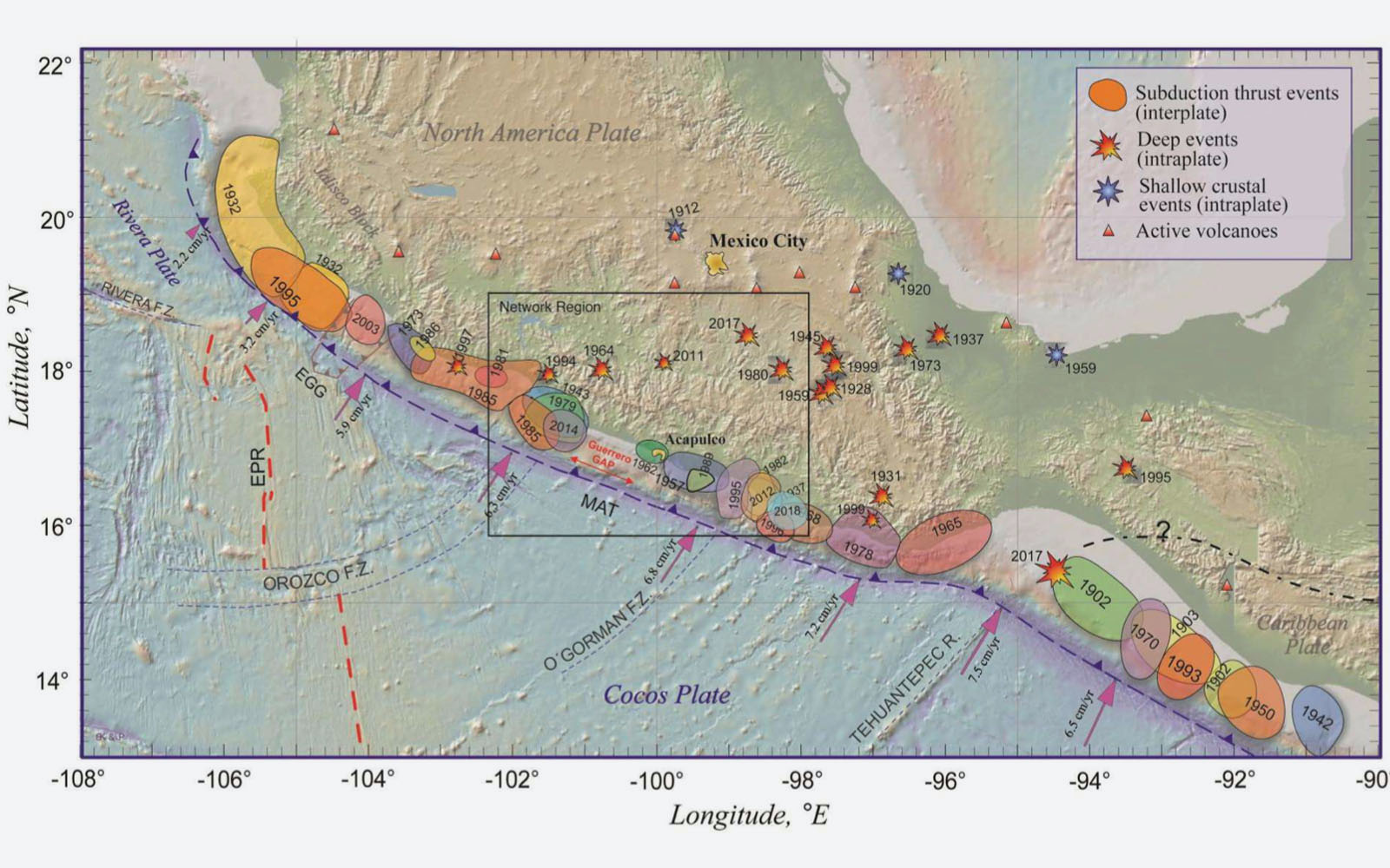
Research project study region.
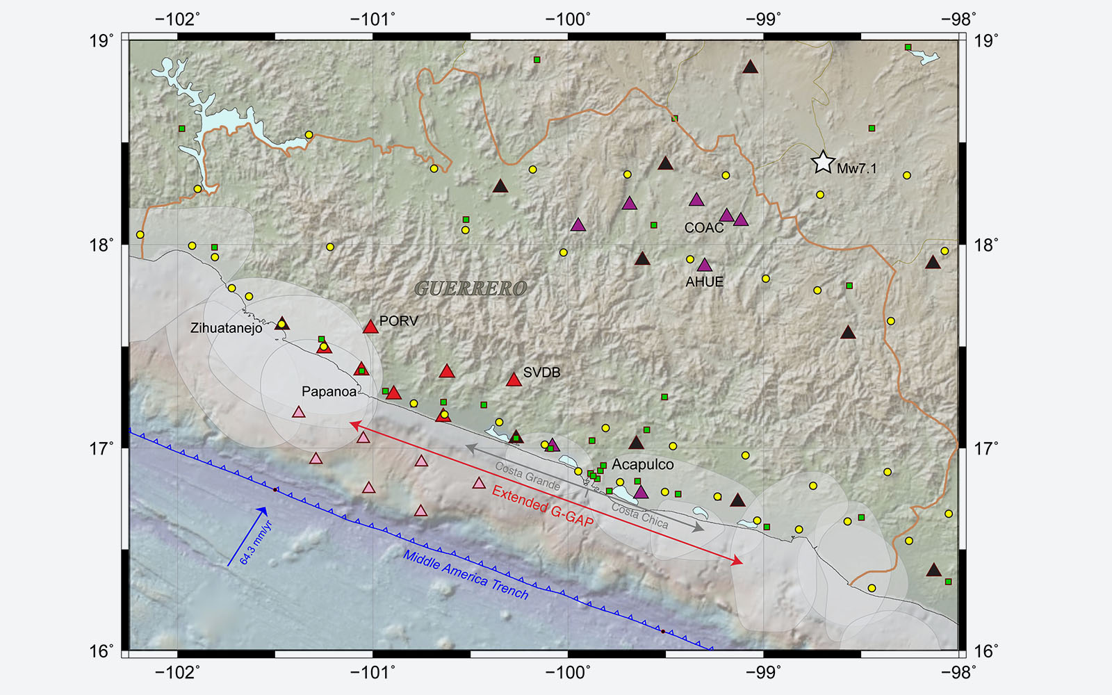
Seismological amphibious network in the Guerrero seismic gap (GGap) and nearby regions. Broadband seismic stations donated by Japan (red triangles), broadband seismic stations from Mexico-National Autonomous University of Mexico (UNAM) (purple triangles), broadband and strong motion from the Servicio Sismológico Nacional (SSN)-UNAM (black triangles), ocean-bottom seismometers (OBSs) donated by Japan (pink triangles), strong-motion stations from the Institute of Engineering-UNAM (green squares), and strong-motion stations from Centro de Instrumentación y Registro Sísmico (CIRES)-SASMEX (yellow circles).
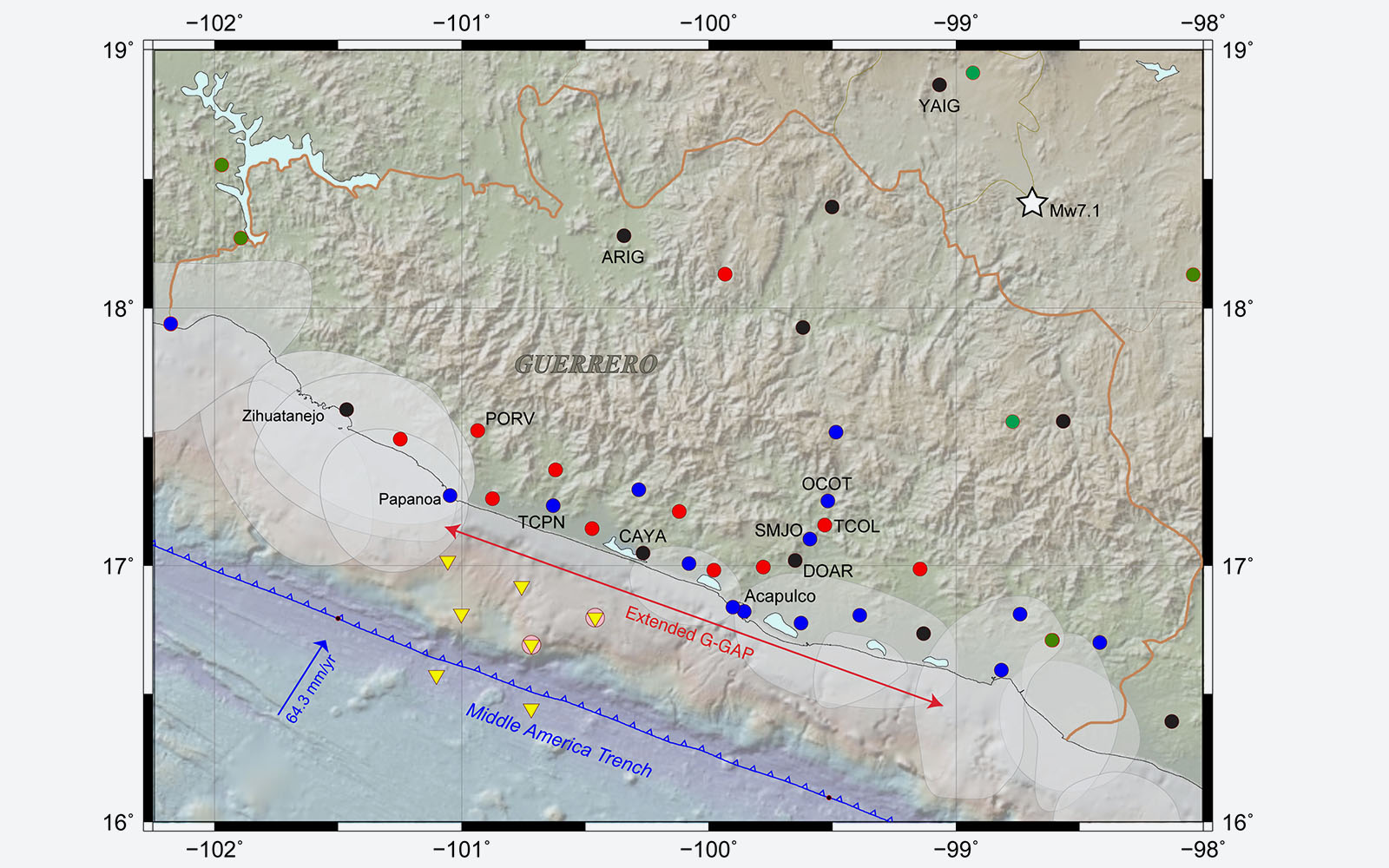
Geodetic amphibious network in the Guerrero seismic gap and nearby regions. Global Positioning System (GPS) stations donated by Japan (red circles), GPS stations from Mexico-UNAM (blue circles), GPS stations from the SSN-UNAM (black circles), GPS stations from TLALOCNet Mexico-UNAM (green circles), ocean-bottom pressure gauges (OBPs) stations donated by Japan (yellow triangles), and GPS-acoustic (GPS-A) arrays from Japan and Mexico (pink circles).
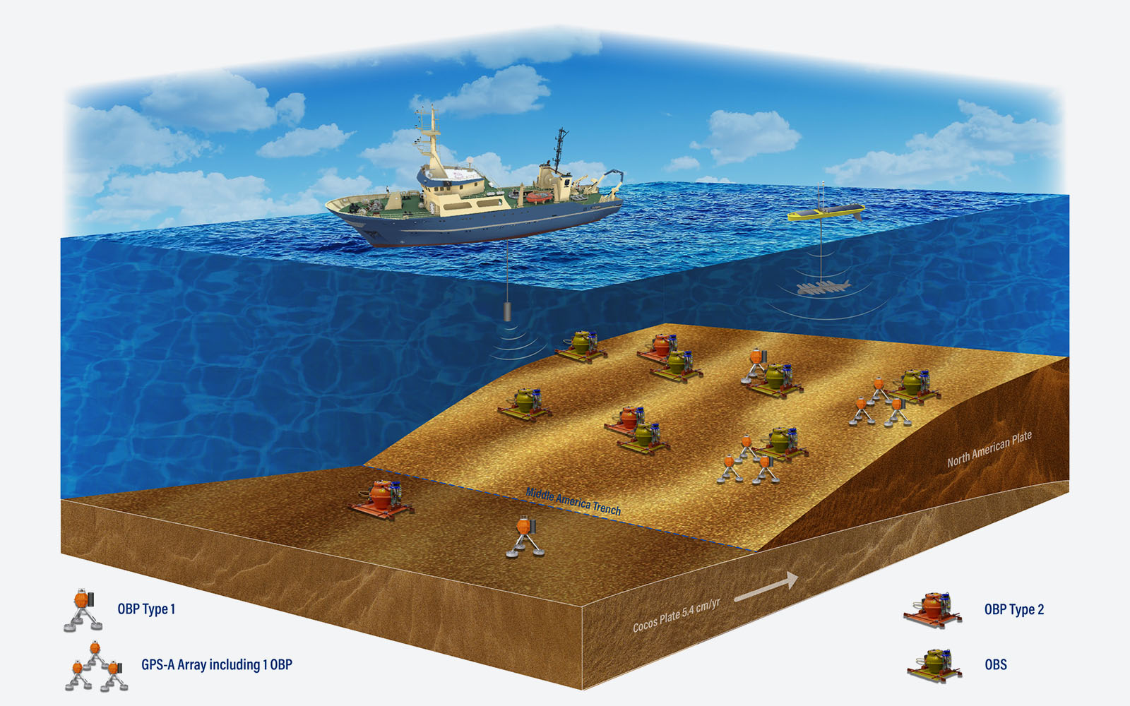
Schematic illustrating the ocean-bottom instruments deployed in the GGap, which consists of seven OBSs, seven OBPs, and two GPS-A sites (see Table 1 for details). Notice that each GPS-A site is composed of an array of three transponders. In the surface, we illustrate both the R/V El Puma and the Wave Glider used for the GPS-A measurements.
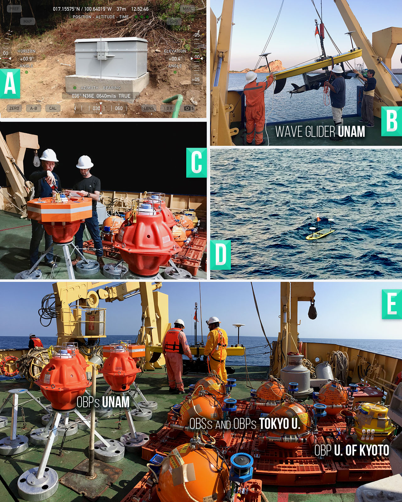
Some instruments and infrastructure of the seismogeodetic network. (a) Typical steal case with concrete base and 1.5-m-deep borehole (not shown) used for the installation of onshore broadband seismometers, (b) deployment of the Wave Glider vehicle from the R/V El Puma of UNAM, (c) acoustic configuration of deep-water OBPs, (d) operation of the Wave Glider in open ocean, and (e) different ocean-bottom instruments in the R/V El Puma during the network deployment in November 2017.